Contents | Atlas | Index | Google Earth | Glossary
Geography as a spatial science


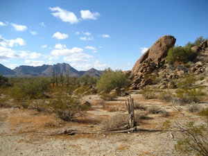
The key question facing most sciences is “how” and thus focus on the process whereby something comes about regardless of time or place. Geography is described as a spatial science because it focuses is on “where” things are and why they occur there. Geographers seek to answer all or more than one of four basic questions when studying our environment. These relate to location, place, spatial pattern, and spatial interaction. Let’s look at how a physical geographer answers these questions about a desert.
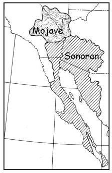
Location: Location is defined as “the position in space” of something. Latitude and longitude is a convenient way to locate something’s position. The Sonoran Desert is located at a latitude and longitude of 33°40’N, 114°15’W. This defines the Sonoran Desert’s absolute location. It actually covers an area of 311,000 square kilometers (120,000 sq mi) between 25° to 33° North and longitude 105° to 118° West. We can also define the Sonoran Desert in relation to a known location, called its relative location. “The Sonoran Desert wraps around the northern end of the Gulf of California, from northeastern Baja California through southeastern California and southwestern Arizona to western Sonora.” (Wikipedia)
Place. Geographers describe place as “… the human and natural phenomena that give a location its unique character …” (Gershmel, 2009). A geographer may want to know how the Sonoran Desert compares to the Sahara desert. To answer this question, a physical geographer will collect data to compare their temperatures and precipitation, and contrast the vegetation, soils and fauna found there.
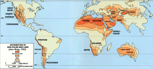
Spatial Pattern. Geographers are especially interested in the arrangement or patterns of earth phenomena. We might want to know – “What is the distribution of deserts on the Earth?”. By examining a map of world climates we find deserts in the dry interiors of the subtropics and midlatitudes.


Spatial Interaction. Finally, geographers are interested in how elements of the earth system interact with one another to create geographic patterns. A geographer might ask – “How do mountains interact with weather systems to affect the distribution of deserts?” By looking at maps of mountain systems, wind and precipitation patterns and, maps of climate we find that mountains oriented perpendicular to the flow of wind create moist conditions on the windward side and dry conditions on the leeward side. The dry leeward side is described as being in the “rain shadow”. In many parts of the world deserts, like the Sonoran Desert of the United States is found in the rain shadow.
Fundamentally, geographers are concerned with where something is at, why it’s there, and how it relates to things around it. They address this through defining where their object of inquiry is located, what the place is like, uncovering its distributional pattern, and understanding how it interacts with its environment. Our interest in understanding the geography of earth goes back centuries and will continue to intrigue us far into the future.
Video: The Geospatial Revolution
Courtesy Penn State Public Broadcasting
For Citation: Ritter, Michael E. The Physical Environment: an Introduction to Physical Geography.
Date visited. https://www.thephysicalenvironment.com/
Please contact the thePitts (host) for inquiries, permissions, corrections or other feedback.
Lisa Pitts (host@thephysicalenvironment.com)
Help keep this site available by donating through PayPal.
This work is licensed under a Creative Commons Attribution-ShareAlike 4.0 International License..