Landforms of Alpine GlaciationA region altered by an alpine glacier is depicted in Figure 19.26. Refer to this diagram as you read about the various landforms created by alpine glaciers.
Figure 19.26 Diagram of alpine glacial landforms ( Source: Wikipedia, United States National Park Service. Public Domain.) The headwaters of stream tributaries serve as the birth place for alpine glaciers. The headwaters of tributary valleys lie at the highest elevation in the drainage basin of a mountain stream. Here snow accumulates to great thickness and starts to move down valley. As it moves outward from the zone of accumulation, the glacier scours away at the valley sides. The material eroded from the surface is transported the length of the glacier to the zone of ablation, where it is deposited.
At the zone of accumulation where ice is accumulating, the glacier
plucks rock from the head of the valley. The erosion creates a huge,
amphitheater-like depression at the valley head called a cirque.
Figure 19.28 U-shaped trough in the Alps (Photo: M. Ritter) The massive amount of ice that fills the main valley is from that
which accumulates at the head of the valley plus that from all the tributary valleys that enter it.
The enormous weight of the ice erodes away at the valley sides. The
V-shape of the pre-existing stream valley now takes on the characteristic
U-shaped of a glacial trough.
Prior to glaciation, tributary streams entered the main stream at the
elevation of the main channel. But during glaciation, tributary glaciers feeding into the main valley
are smaller and do not erode their valleys as deep as the glacier that occupies the main
valley. Tributary valleys
are left hanging at a higher elevation above the main valley floor as a result of more intensive downward cutting by the main
valley glacier.
These hanging valleys create
spectacular waterfalls.
Glaciers in adjacent tributary valleys scour away at the upland
between them (an interfluve). As erosion of the interfluve continues, it
is narrows into a serrated ridge known as an arête.
|
|
|
Figure 19.30 Niwot Ridge arête, Colorado Front Range (Photo: M. Ritter) |
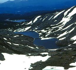
Figure 19.31 Staircase lakes, Green Lakes
Valley, |
|
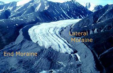
Figure 19.32 Lateral and end moraine. (Courtesy Geological Survey of Canada) Glacial till is deposited along the valley sides as
lateral
moraine.
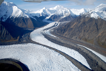
Figure 19.33 Medial moraine forming from the merger of lateral moraines (Courtesy USGS) Explore some of alpine gacial landforms by taking a virtual field trip to Niwot Ridge, Colorado in Google Earth or with the embedded viewer below (Google Earth plugin required).
Figure 19.34 "Hanging Glaciers"
|
|
For Citation: Ritter, Michael E. The Physical Environment: an Introduction to Physical Geography.
Date visited. https://www.thephysicalenvironment.com/
Please contact the thePitts (host) for inquiries, permissions, corrections or other feedback.
Lisa Pitts (host@thephysicalenvironment.com)
Help keep this site available by donating through PayPal.
![]()
This work is licensed under a Creative Commons Attribution-ShareAlike 4.0 International License..

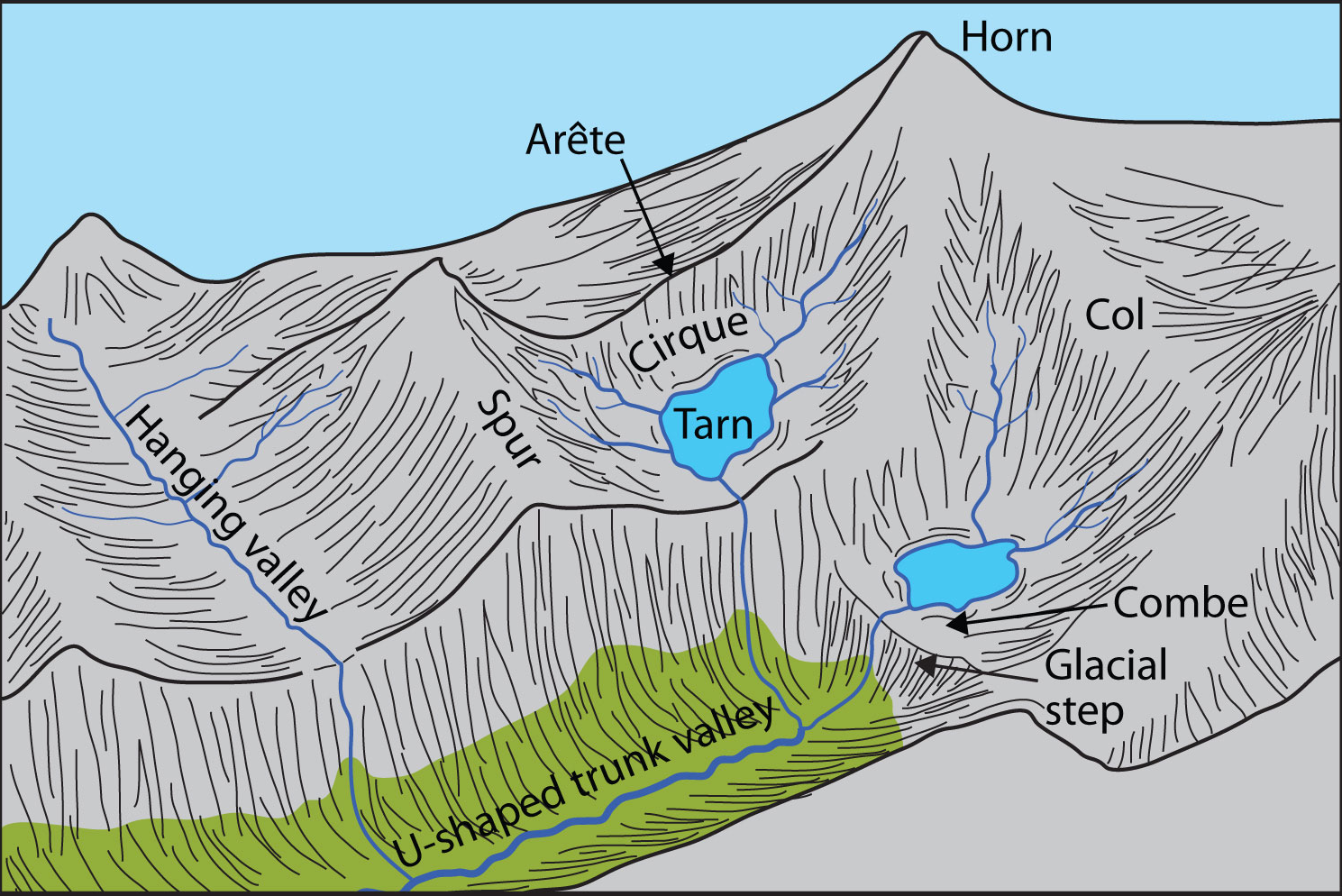
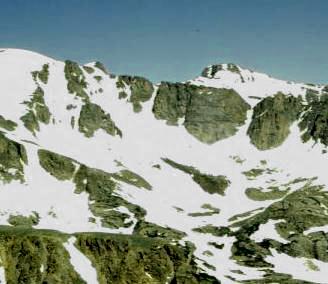 Figure 19.27 Pawnee Cirque, Front Range, Colorado (Photo: M. Ritter)
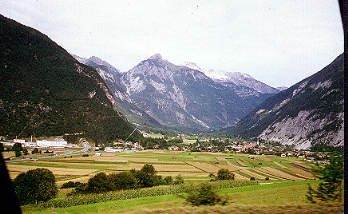
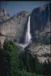 Figure
19.29 Hanging valley in Yosemite National Park.
Figure
19.29 Hanging valley in Yosemite National Park. 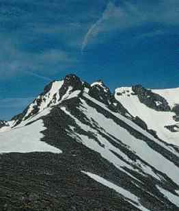