Digging Deeper: The April 27, 2011 Southern USA Tornado Outbreak
April 27-28, 2011 the southeastern United States was struck by an estimated 211 tornadoes. Wreaking havoc over eight states, more than 340 people lost their lives as whole towns were destroyed across Alabama, Arkansas, Georgia, Mississippi, North Carolina, Tennessee, and Virginia. It was the most deadly day since March 18, 1925 when 747 people died.
Figure DD 8.1 GOES satellite image animation.
Courtesy NASA Earth Observatory
The perfect conditions for tornado development were closely monitored by the National Weather Service days prior to the events of April 27-28. Warm, moist air at the surface streamed ashore from the Gulf of Mexico. With cold air aloft, highly unstable atomospheric conditions ahead of a strong cold front sweeping drier air behind it. A strong westerly jet stream aloft combined with surface winds from the south and east triggered strong vertical wind shear providing lift to the air. Using composite indices based on these conditions, NOAA's Storm Prediction center issued a "high risk" alert for tornadic conditions more than 12 hours in advance. Beginning inthe afternoon of the 26th, thunderstorms exploded in the unstable air. The National Weather Service's worst nightmare was about to come true.
Figure DD 8.2 April 27, 2011 Tornado Outbreak
Courtesy NOAA Weather Partners Video Library
Across the southern United States roared a storm system producing some of the largest tornadoes on earth, supertwisters. A rare EF-5 tornado a half mile wide ripped through the community of Smithville, Mississippi at 3:44 pm on the April 27. With estimated peak winds of 205 mph, dozens of homes and businesses were pulled from their foundations. The town's water system was destroyed. Most trees were broken, twisted and stripped of their bark. A second F5 tornado touched down near Hackleburg, Alabama. It was the first time since 1990 that two F5 supertwisters formed on the same day.
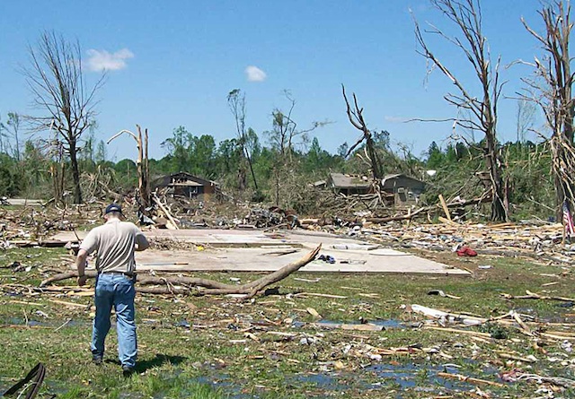
Figure DD 8.3 Slab foundation stripped of house. Debarked hardwood trees in background.
Courtesy NOAA Weather Forecast Office Memphis (Source)
Barely a month later, Joplin Missouri was struck by a multi-vortex EF5 tornado on May 22, 201. Estimated at 1.21 km (.75 miles) wide, as it tracked at least 11 km (7 miles) across the city. With winds over 200 mph. Over 125 people were killed and hundreds injured making it the deadliest since modern records have been kept and the eighth-deadliest single tornado in U.S. history.
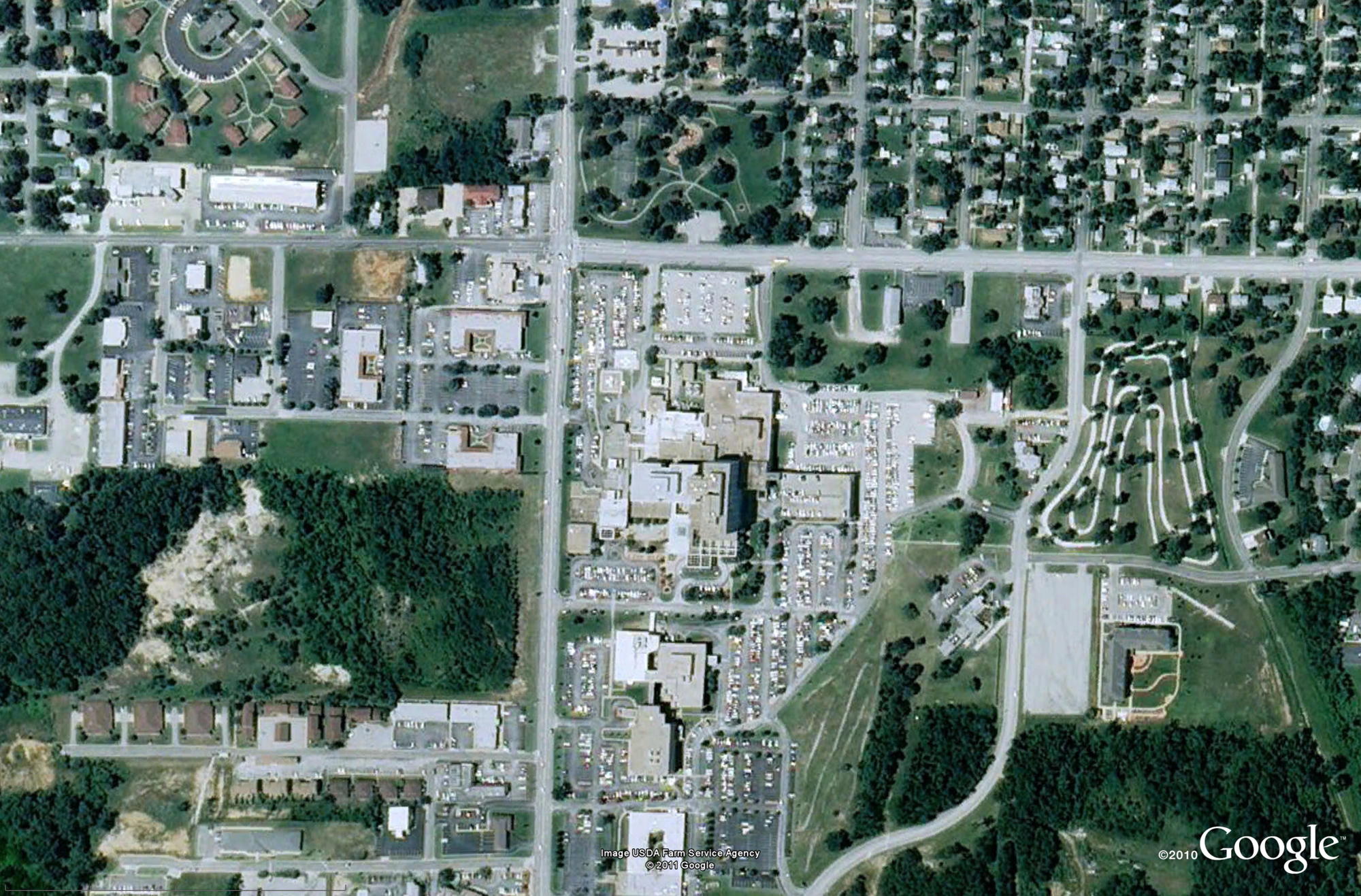
St. John's Hospital: Before Courtesy NOAA (Source)
Click image to enlarge
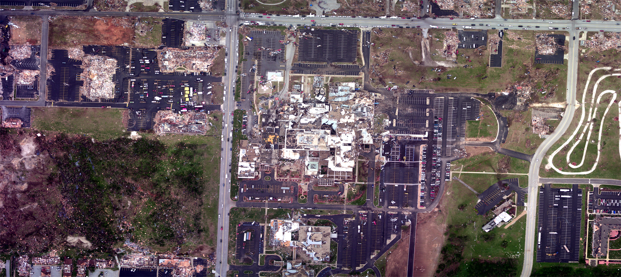
St. John's Hospital: After Courtesy NOAA (Source)
Click image to enlarge
