The Physical Environment
                                          Contents | Glossary | Atlas |  Index | TPE Today | Google Earth | Search

Loess

loess

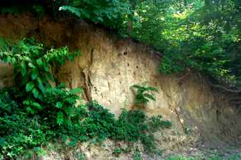
Figure 20. 12 Loess deposit on bluff above the Illinois River, Pierre Marquette State Park, Illinois. (Courtesy M. Ritter) Click image to enlarge

Loess is principally wind deposited silt, much of which was eroded from Pleistocene glacial sediments. Vast accumulations are spread across the upper Midwest United States, with significant deposits along major rivers like the Mississippi. As glaciers advanced across North America they ground the underlying rock into a powder-like "glacial flour". This sediment is laid down by glacial melt water and later eroded from the dry deposit by strong wind. The Loess Hills of Iowa and Loess Plateau of China are two well-known examples of loess topography.


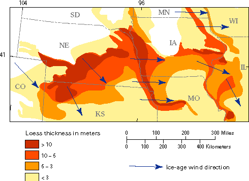
Figure 20.13 Loess map of Iowa and surrounding region.
Courtesy USGS
Source: https://pubs.usgs.gov/fs/FS-016-99/index.html#fig3

Previous | Continue  


Contents |Glossary | Atlas Index  |  Blog | Podcast | Google Earth | Search Updates | Top of page

About TPE | Who's Used TPE |  Earth Online Media

Please contact the author for inquiries, permissions, corrections or other feedback.

For Citation: Ritter, Michael E. The Physical Environment: an Introduction to Physical Geography.
Date visited.  https://www.earthonlinemedia.com/ebooks/tpe_3e/title_page.html

Michael Ritter (tpeauthor@mac.com)
Last revised 6/5/12

Creative Commons License
This work is licensed under a Creative Commons Attribution-ShareAlike 4.0 International License..