Ocean Circulation and Atmospheric CirculationLike the circulation of air, the circulation of the world's oceans is important in the latitudinal redistribution of energy. Warm ocean currents are corridors of warm water moving from the tropics poleward where they release energy to the air. Cold ocean currents are corridors of cold water moving from higher latitudes toward the equator. They absorb energy received in the tropics thus cooling the air above. A distinct correlation between the pattern of ocean currents and the air circulation above them can be made. Ocean currents
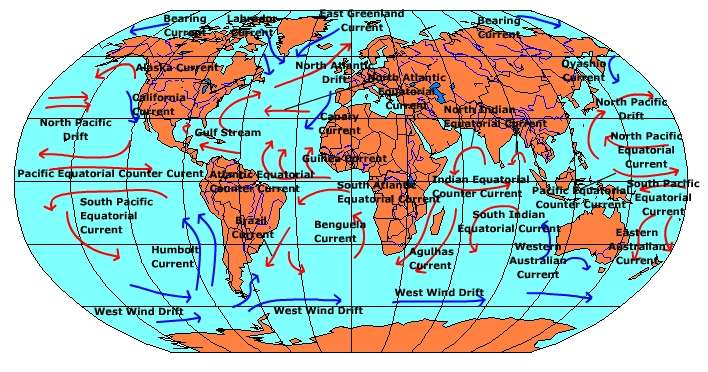
Figure 6.22 Major ocean currents The major ocean currents are wind-driven currents, though some ocean currents result from density and salinity variations of water. The subtropical high pressure cells are responsible for many of the Earth's great ocean currents. Examine the location of the subtropical highs and then place their position on the map of world ocean currents. See any correlation? Notice how the position of the subtropical highs and the circulation around them coincide with the circulation of many of the world's ocean currents. Take the Gulf Stream for example. As air blows out of the western side of the subtropical high it flows over a warm pool of subtropical water dragging it northward creating a warm ocean current. Approaching the eastern seaboard of the United States it is deflected toward the northeast flowing towards the north Atlantic and Europe. After crossing the Atlantic it turns into the North Atlantic Current (Drift). The Gulf Stream enhances instability and the likelihood for precipitation as air passes over it. The warmth of the North Atlantic Drift moderates the climate of The British Isles.
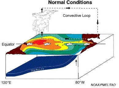
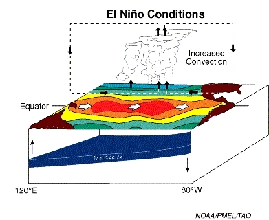
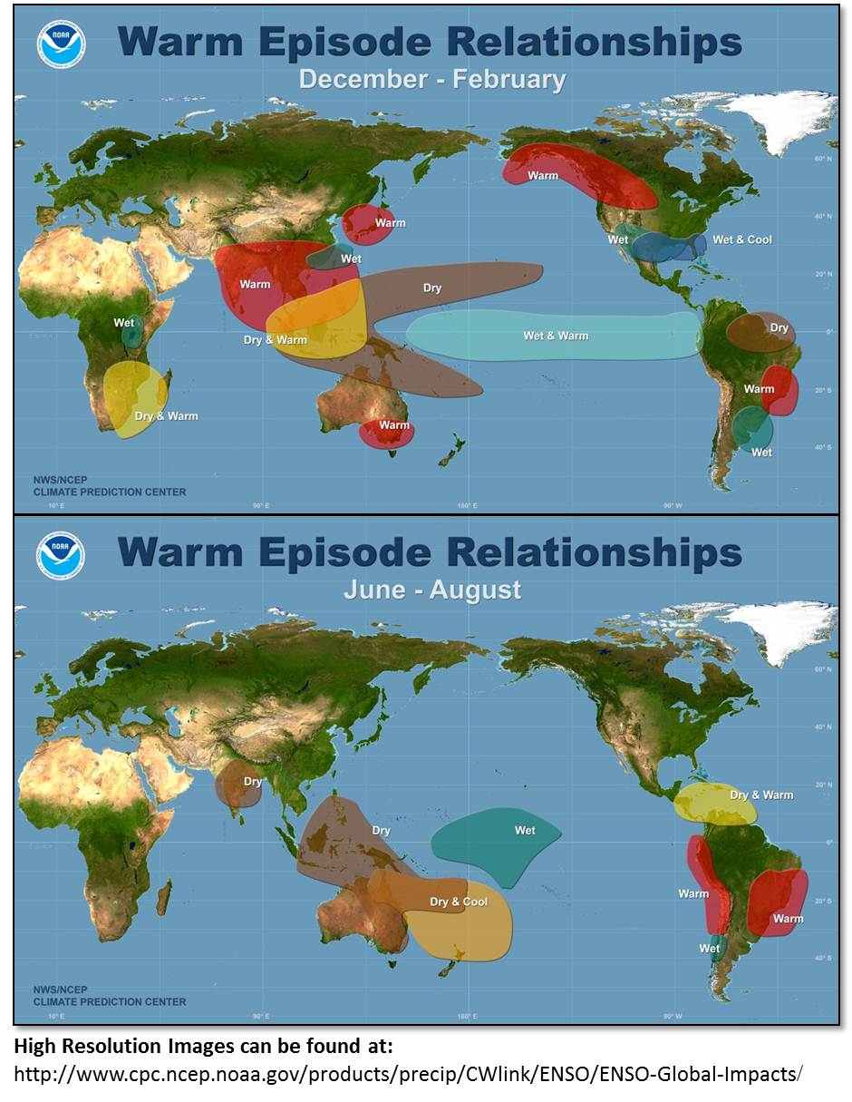
As air circulates around the eastern sides of the subtropical highs it blows over cold pools of water dragging them equatorward creating cold ocean currents. The Peru Current is a wind-driven cold current that flows along the coast of South America. Air moving over the cold current is stabilized, inhibiting uplift, the development of clouds and precipitation. Cool coastal deserts form along some coasts that are bordered by cold ocean currents, for example, the Atacama Desert. These deserts derive their meager moisture from fogs that form when warm, moist air masses from further out in the ocean travel over the cold current causing condensation. Examine the map of ocean currents. The circulation of air around the subtropical highs and the currents it creates creates a general pattern to the distribution of cold and warm ocean currents. Generally speaking, warm currents are found along the east coasts of most continents and cold ocean currents along west coasts. We'll see how this pattern affects the distribution of climates in chapter 9 "Climate Systems". El Niño and La NiñaFor centuries, we have recognized a seasonal change in Pacific ocean circulation. Peruvian fisherman in the late 1800's named the seasonal swing of ocean water "El Niño" (Spanish for the "Christ Child") as it usually occurred around Christmas. A periodic weakening of the trade winds in the central and western Pacific allows warm water to invade the eastern Pacific. Along the Peruvian coast, the encroaching warm water displaces the nutrient-rich north-flowing cold ocean current causing a decline in fisheries. Today, the phenomenon is known as the " El Niño/Southern Oscillation" and we are coming to understand how this change in the seasonal wind and ocean circulation impacts global weather patterns (See December - February conditions; June - August conditions). Cooler than normal ocean temperature in this region is called "La Niña". It too has significant impacts on worldwide weather.
|
