Tropical Monsoon Climate (Am)
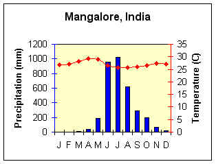
Lat/Long = 12.53o N, 74.52o E
Average Annual Temperature (oC) = 27.05
Annual Temperature Range (oC) = 3.6
Total Annual Precipitation (mm) = 3409.2
Summer Precipitation (mm) = 3115.9
Winter Precipitation (mm) = 293.3

Map Location

Tree Cutting in Monsoon forest, Myanmar.jpg (34952 bytes)

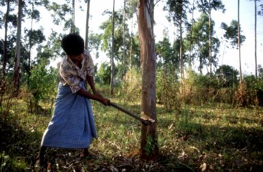
Farmer cutting eucalyptus in wood lot, Myanmar

(Photo credit: FAO #19771 G. Bizzarri. Used with permission)


Geographic Distribution

Britannica Online Climate Map

  • Coastal areas of southwest India,

  • Sri Lanka, Bangladesh, Mynamar (Burma),

  • Southwestern Africa,

  • French Guiana,

  • northeast and southeast Brazil.


Controlling Factors

  • Summer onshore/winter offshore air movement related to shifting ITCZ or monsoon circulation.

  • mE air masses during high-sun; stable mT or cT -> low-sun

Characteristics

  • Heavy high-sun rain; short low-sun drought.

  • Highest temperature just before rainy period.

Question for thought:

  • What's responsible for the two peaks in the temperature curve on the climograph for Mangalore?


Back to Interactive Climate Map

Creative Commons License
This work is licensed under a Creative Commons Attribution-ShareAlike 4.0 International License..